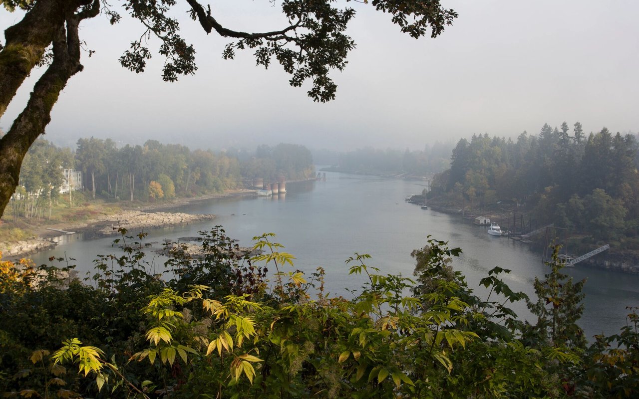
In the 1880s and 1890s, settlers filed donation land claims on the steep slopes above the Willamette River, planning to clear the Douglas fir and build homes. Logging loosened the silt, heavy rain did the rest, and landslides ran through those claims fast enough to defeat construction outright. Owners defaulted or donated their acreage rather than keep fighting the hill. Piece by piece, over several decades, those forfeited claims became Forest Park.
That backstory isn't trivia for anyone buying or listing a home along today's Forest Park border. The geology hasn't changed. The same wind-deposited silt sitting on ancient basalt that defeated those 19th-century building attempts is still under the driveways, decks, and foundations built into these hillsides now. What's changed is how the risk gets handled on paper. Oregon's disclosure form asks sellers one specific question about it. Insurance underwriters ask something else entirely. Buyers who only read the first one are working from half the picture.
The Question on the Form
Every Oregon home sale requires a Seller's Property Disclosure Statement, and one line asks directly whether the property sits in a designated slide or other geologic hazard zone. Yes, no, or unknown.
The operative word is designated. The question isn't whether the ground moves. It's whether a government body has mapped it as a hazard zone. In Portland, that mapping exists mainly to govern land divisions: if any part of a site falls inside the city's Potential Landslide Hazard Areas map, a land division application must come with a Landslide Hazard Study from a certified engineering geologist and a geotechnical engineer. That map and that requirement were built for subdividing raw land, not for auditing every existing single-family lot platted and built decades before the mapping program existed.
A seller on a hillside street near the park can honestly check "no" on that box. Their parcel may never have been individually mapped. It may sit just outside a drawn boundary that reflects when a survey was done more than how steep the actual slope is. A "no" answer is a statement about paperwork, not a geology report.
| Disclosure form | Insurance underwriting | |
|---|---|---|
| What it measures | Whether a government body has mapped the parcel as a hazard zone | The actual slope, drainage, and history of movement on that specific lot |
| Who answers it | The seller, based on their own knowledge | An insurer, based on underwriting criteria |
| When it's checked | Once, at listing | Fresh, at every policy application |
What the Insurer Actually Prices
Insurance underwriting doesn't ask about designations. Standard homeowners policies exclude landslide, mudflow, and other earth movement damage across Oregon, on flat lots and hillside lots alike. Coverage for that specific peril comes from a separate Difference in Conditions policy, and what it costs depends on the physical characteristics of the parcel: slope, proximity to a bluff, and any history of ground movement nearby. The Northwest Insurance Council puts a rough example at about $1,000 a year for a $300,000 home in a higher-risk area, a figure that tracks the slope of the lot regardless of what the county's hazard map says about it.
Oregon's insurance commissioner has said plainly that "many people may not know that their home is not covered for these types of perils." That's the gap in practice: the disclosure box is administrative, the underwriting is physical, and they run on separate tracks that only meet each other after a buyer applies for coverage.
What Happened on Skyline Boulevard
That gap became a legal fight in a case that starts on the ridge bordering the park. In February 2017, a landslide on a Portland hillside property closed a stretch of Skyline Boulevard for three days. The city ordered the landowner to stabilize and repair the slide. His insurer denied the claim twice over: no coverage for the landowner's own property because of the standard earth movement exclusion, and no liability coverage either, since the dispute was framed as damage to the landowner's own land rather than harm to anyone else's.
The federal court hearing Pollock v. Amica Mutual Insurance Co. split that argument. The earth movement exclusion held for the property coverage, exactly as it's written into every standard homeowners policy in Oregon. But the city's cleanup order concerned the public right of way, which put it on the liability side of the policy, and liability exclusions have to be written into the liability section specifically to apply there. The court found the insurer owed a duty to defend the city's claim, then a duty to indemnify.
The takeaway for anyone owning a slope near the park isn't about that one case. It's that a landslide on a hillside lot can open two separate insurance questions at once: one for damage to your own house, and one for damage that reaches a road, a trail, or a neighbor's property. A policy silent on one can still leave you exposed on the other.
For Land Buyers, the Study Isn't Optional
If you're buying raw acreage near the park rather than an existing house, the Landslide Hazard Study stops being a talking point and becomes a line in the application itself. Portland requires it whenever any part of a site sits within the mapped hazard area, and if the underlying study is more than two years old, the applicant has to provide a written addendum confirming the recommendations still reflect current site conditions. Ground here doesn't hold still on paper any more than it does in the rain.
Before You Write an Offer or Sign a Disclosure
None of this argues against buying near the park. Homes bordering Forest Park's trail network carry a kind of access and quiet that flat-lot neighborhoods don't offer, and most owners never see a slide during the life of a mortgage. But the disclosure form and the underwriting are measuring different things, and treating a clean checkbox as the full picture is how buyers get surprised at closing.
A few habits close that gap. Look up the parcel in Oregon's public landslide database before writing an offer, not after. Ask a seller's agent whether "unknown" was checked because nobody ever looked, which happens more often on older hillside lots than most buyers assume. Get a landslide insurance quote during the inspection period, not the week before closing. And if you're selling, know that answering the form honestly protects you on the form. It does nothing to change what a buyer's insurer finds when they underwrite the actual slope.
A Few Questions We Hear Often
Does a "no" on the geologic hazard question mean my lender won't require special insurance? No. Lenders and insurers assess the physical property, not just the disclosure form, and a Difference in Conditions policy can still be required or strongly recommended based on slope and location even when the parcel isn't in a mapped hazard zone.
Is Forest Park itself more prone to slides than other West Hills neighborhoods? The whole West Hills range sits on the same wind-deposited silt over basalt that shaped Forest Park's history, so the underlying risk factors are regional rather than unique to lots directly bordering the park. Slope, drainage, and site-specific grading matter more than which side of a boundary line a lot falls on.
Where can I check a specific address myself? Oregon's Department of Geology and Mineral Industries maintains a public tool called SLIDO, the Statewide Landslide Information Database, and Portland's mapped hazard areas are viewable through the city's GIS system. Neither replaces a geotechnical report, but both are worth a look before you get attached to a listing.
If you're weighing a home near Forest Park, or getting ready to list one, ELEETE Real Estate can walk you through what the disclosure form covers, what it doesn't, and what to line up before you're under contract. Request a strategic consultation and bring the address.