On January 15, 2024, three days into that winter's ice storm, the Portland Bureau of Transportation's list of closed roads included NW Miller Road from Miller Hill Drive to Forest Creek Road, closed by a downed tree. The same list closed NW Cornell Road from NW Miller to NW Skyline Boulevard for downed trees and power lines, according to KATU's report on the PBOT update. Miller also carries the Forest Heights HOA shuttle's stops, and both closures came from trees and power lines rather than snow depth.
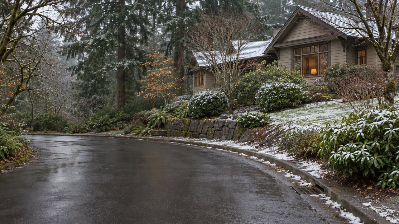
For a household comparing Westside neighborhoods, the storm record shows that what a winter morning looks like here is decided street by street. City crews concentrated on Miller and Thompson in past storms, and neighborhood side streets in the West Hills stayed packed for days. Some Forest Heights streets are private, and their owners pay a separate assessment on top of HOA dues. Two homes under the same homeowners association can face very different conditions on the same storm morning, so it pays to ask about the specific street before writing an offer.
The city's share is the arterials
PBOT is in winter ready mode from November 1 to March 15, so by Thanksgiving the season's plan is already in effect. Its "snow and ice" routes cover about a third of Portland's street grid, roughly 1,749 of the 4,881 lane miles the bureau maintains. The goal on those routes is at least one passable lane in each direction for vehicles with front-wheel drive or traction devices. PBOT's Winter Weather Basics and FAQ says anti-icing the routes can take up to three 12-hour shifts in a severe event, and plowing them after a major snowfall can take up to one 12-hour shift.
For Forest Heights, the arterials named in local storm coverage are NW Miller Road and NW Thompson Road. During the back-to-back storms of December 2016, KATU reported that PBOT crews had plowed NW Thompson and NW Miller "but not many neighborhood side streets." PBOT's Winter Weather Center map is the current record of which roads are on the routes. During a storm it also shows where plows and salt trucks are in real time. If you are touring homes this winter, look up the route from a particular driveway to Miller or Thompson on that map before you treat a listing's "minutes to Highway 26" as a year-round figure.
Inside the neighborhood, the city steps back
After the February 2023 snowstorm, KOIN reported that streets around the West Hills were still packed with snow nearly a week later, even though PBOT said all primary streets had been plowed and were passable. A PBOT spokesperson explained the gap to the station: "We do not plow or treat neighborhood streets. Many of them are steep. Any that are steeper than 14% grades, presented danger to our crews and our equipment." Main roads that are open and a home's own street that is open can be days apart.
Forest Heights has partly filled that gap itself. In December 2016, the Forest Heights Homeowners Association told KATU that it had invested in two snowplows to help the city clear residential streets. The HOA's general manager at the time described the limits plainly: "We do not pre-treat the roads (we don't have the space or equipment) and our plows can only go to 1" above the pavement. Therefore, for some snow events (like this one), most of the snow packed into ice and our plow couldn't do much." The same report said the HOA's plow was back out clearing snow and slush the following Monday. That account is from 2016. Ask the association how it handles storms now before you rely on it.
Private streets carry their own line item
Forest Heights is not all one kind of street. The FHHOA's page for prospective buyers says every homeowner pays semi-annual dues of $449, or $898 a year. Owners who live on private streets also pay a separate Private Street Assessment each January, set at $736 for 2026. According to the same page, the assessments support "the maintenance of several private streets" along with 200 acres of common area, 6 miles of private trails with 27 trailheads, a private pond, park and playground, and the neighborhood's private shuttle. These figures are general information and not legal, tax or financial advice, so confirm what applies to a specific property with the association and the right professional.
The assessment is a cost question and a winter question at once. Whether a home sits on a private street, a public residential street or a block close to Miller or Thompson changes who is responsible for that pavement and how long after a storm it is likely to be cleared. The association's master structure is large: 1,126 single-family homes, plus 681 townhomes and condominiums in 14 sub-associations, across 17 neighborhoods. Generalizing about "Forest Heights in the snow" covers too many different streets to be useful. The association directs buyers and sellers to CondoCerts for a "Homeowners Reference" package during due diligence, and that package is the place to settle a specific home's street status and assessments.
The roads out close for trees as often as for snow
In the last two major storms, ice and downed trees closed the West Hills roads around Forest Heights for longer stretches than snow alone did.
In April 2022, a PBOT traffic advisory warned that major West Hills routes would stay closed for several days while utility and forestry crews cleared power lines and downed trees. The closures included W Burnside, NW Skyline Boulevard from W Burnside to NW Cornell, and NW Cornell Road at NW Miller Road. U.S. 26 was also closed for a time before reopening, according to the city's advisory.
The January 2024 ice storm followed the same pattern. Besides the January 15 closures on Miller and Cornell, the Oregonian's January 19 list of PBOT closures still showed NW Cornell from Miller to Skyline closed for trees and power lines. It also listed NW Barnes from West Burnside to NW 48th and SW Skyline from West Burnside to Barnes. That same day, KOIN reported that a tree shut Barnes Road for several hours and that West Hills roads including Germantown, Barnes and Burnside had ice and downed-tree problems amid widespread outages in the western metro.
Miller, Cornell and Barnes each appeared on a closure list in one of those storms. A buyer who depends on a single route for a daily commute or a school drop-off should drive the alternates during the dry months.
Elevation decides who gets the forecast
Forest Heights sits in the West Hills, and that part of the city often gets winter weather that skips the valley floor. On February 18, 2026, KOIN reported a winter weather advisory for Portland's West Hills and other elevations of 1,000 feet or higher, with 1 to 3 inches of snow possible in the West Hills through that Thursday night. KOIN 6 Meteorologist Steve Pierce said the system should not affect travel on the valley floor in the immediate Portland and Vancouver metro area through Thursday morning.
PBOT's Winter Weather Center map includes 500-foot and 1,000-foot elevation contours along with National Weather Service ice-accumulation forecasts, so you can trace a particular commute against the elevation lines. For families also looking at Bethany or Cedar Mill, this is the most practical comparison to make. A light-snow advisory for the hills is one kind of morning. A forecast that reaches the valley floor is another.
The HOA's private shuttle is part of the same calculation. The FHHOA shuttle page lists weekday morning and afternoon-evening runs between Forest Heights and Sunset Transit Center, with stops along Miller and Thompson and limited stops on Barnes. Those are the same arterials PBOT plowed in 2016, so a household that relies on the shuttle should ask the association how it operates on storm days. Our earlier post on why Forest Heights runs its own bus line to the MAX covers how the shuttle came to exist.
Before you commit to a Forest Heights address, find out which street the home is actually on, who clears it, and how far it is to Miller or Thompson. Our Forest Heights neighborhood guide has the broader picture, and our post on the siding inspectors flag in Forest Heights covers what wet months mean for the houses themselves.
If you're weighing a Forest Heights home this winter, ELEETE Real Estate can help you sort out its street status, assessments and storm-day routes before you write an offer. Request a strategic consultation and we'll go through the specific address with you.